Would you like to learn more about our method for creating papercraft raised relief maps from digital elevation data? We wrote a paper describing the method that has been included in the proceedings of the 10th Mountain Cartography Workshop. You will find out
- what makes a “good” mesh for papercrafting,
- how we optimise the underlying triangulated irregular network (TIN) to obtain such meshes,
- how our results compare to those of other common methods (regular grid, greedy, QSLIM), and
- tips for unfolding and building the final model.
You can download the paper here.
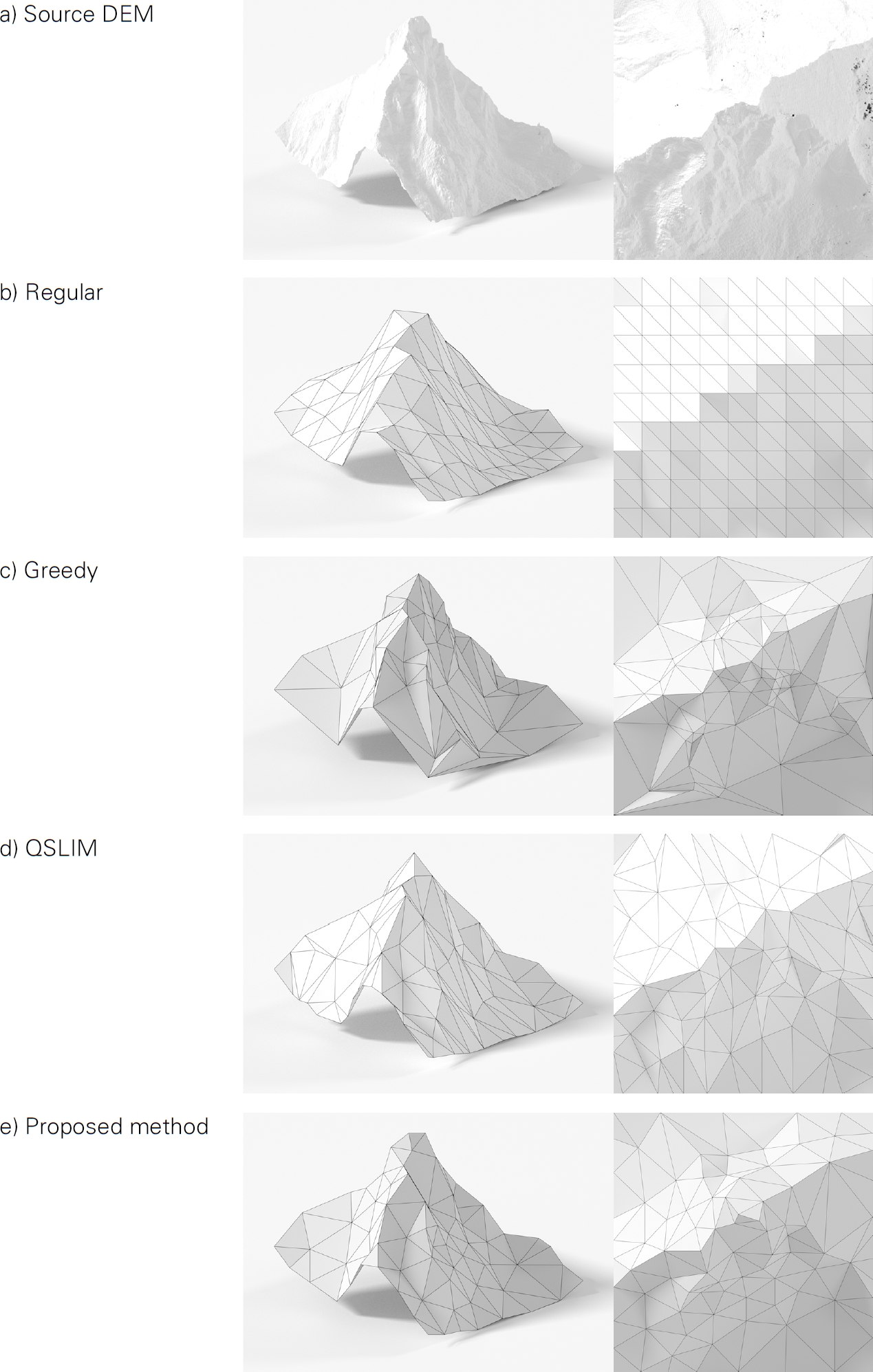
Comparison of the triangle meshes generated using different existing algorithms and the proposed method, showing an oblique and a top-down view.